The Global Positioning System (GPS) is one of the most widely used navigation and positioning technologies in the world today. Its origins can be traced back to the 1960s when the United States Department of Defense initiated a project called NAVSTAR to develop an all-weather, global satellite navigation system. This system was initially designed to meet military needs, providing precise positioning and navigation services.
The Birth of GPS
The development of GPS underwent several stages. The earliest satellite navigation system was the “Transit” system in the 1950s, which used the Doppler effect to determine the position of submarines. However, this system only provided limited coverage and accuracy. To address these issues, the U.S. Department of Defense launched the NAVSTAR GPS project in 1964.

In 1978, the first GPS experimental satellite was successfully launched, marking the practical phase of the GPS system. The design of the GPS system included 24 satellites (21 operational satellites and 3 spares) distributed in six different orbital planes to ensure global coverage. In 1983, after Korean Air Flight KAL007 was shot down by the Soviet Union, U.S. President Reagan announced that GPS technology would be made available for civilian use, putting GPS on a fast development track.
Development and Applications of GPS
The full operation of GPS began in 1993 when all 24 satellites were in place and the system was officially put into use. Initially, the GPS signal had accuracy restrictions for civilian users, but in 2000, the U.S. government lifted these restrictions, significantly improving the accuracy of civilian GPS.
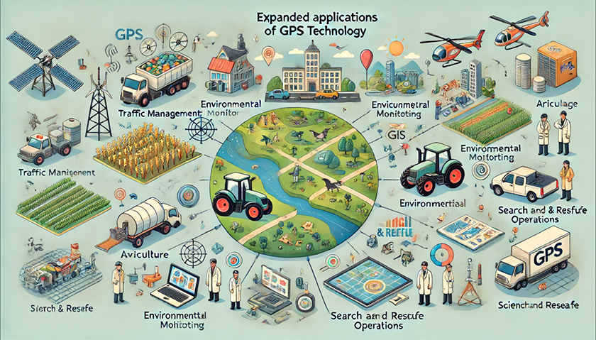
With technological advancements, the range of GPS applications has continuously expanded. In addition to traditional navigation and positioning functions, GPS is widely used in traffic management, agriculture, environmental monitoring, geographic information systems (GIS), search and rescue, scientific research, and more. For example, in agriculture, GPS is used to enable precision farming, improving agricultural production efficiency; in environmental monitoring, GPS helps scientists track wildlife migration paths and ecological changes.
Technological Advancements in GPS
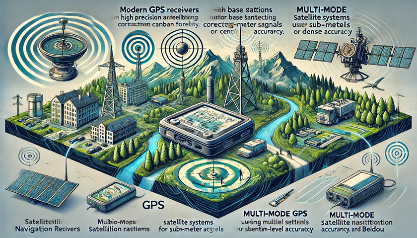
Over time, GPS technology has continuously improved. Modern GPS receivers are more accurate and reliable, providing stable positioning services in various complex environments such as urban canyons and dense forests. Differential GPS (DGPS) technology corrects GPS signals using base stations, achieving sub-meter or even centimeter-level positioning accuracy. Additionally, the emergence of multi-mode satellite navigation receivers allows receivers to use signals from multiple satellite systems such as GPS, GLONASS, Galileo, and BeiDou simultaneously, enhancing positioning accuracy and reliability.
The Future Development of GPS
Although GPS technology is quite mature, there is still room for development. In the future, GPS will further enhance positioning accuracy and service quality, particularly in emerging fields such as autonomous driving, the Internet of Things (IoT), and smart cities, where GPS will play an increasingly crucial role. Moreover, combining GPS with other sensors and technologies (such as inertial navigation systems and Wi-Fi positioning) will make positioning services more comprehensive and precise.

EElink, as a leading GPS positioning service provider, is dedicated to offering the most advanced and reliable positioning solutions to its customers. EElink’s products not only feature high-precision positioning but also incorporate various intelligent technologies, such as real-time tracking, geofencing, and historical route playback, catering to diverse application scenarios. With its outstanding technical capabilities and excellent customer service, EElink has gained widespread recognition and trust in the global market. Choosing EElink ensures a first-class positioning service experience, providing robust support for your business.